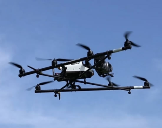
Do-it-all Drones
Siemens is developing systematic inspection systems that use drones and 3D image analysis to monitor pipelines, large industrial facilities, and pylons in high-voltage electrical distribution systems.
Pipelines cover the earth like a web of arteries. They supply us with everything from oil and gas to ammonia, water and even beer. For decades they have been among the safest and most effective means of distributing a wide variety of substances that would otherwise require far more expensive truck or rail transport. But there’s a hitch: pipeline operators need to monitor these vast networks completely whether they are above ground or buried. Indeed, the thickness of the earth layer with which many critical pipelines are covered is a key safety concern. In Europe, for instance, underground gas and oil pipelines are legally required to be covered by at least one meter of soil. In the U.S., which accounts for about 65 percent of the world’s 2.17 million miles (3.5 million km) of pipeline, pipelines are typically buried three to six feet underground*.
Aerial monitoring is generally conducted by helicopters, which fly over pipelines every two to four weeks. However, such visual inspections are expensive and generally lack the equipment to determine whether the layer of earth covering a pipeline is sufficiently thick.
Precise Measurements
All of this is likely to change in the near future, however, thanks to technology from Siemens. “We are developing a new, much more efficient inspection system for the systematic and automated measurement of layer thicknesses from the air with the help of drones,” explains Claudia Windisch from Siemens Corporate Technology. “To do so, we are combining mobile, copter-borne sensors with smart image analysis.”
Equipped with color and near-infrared (NIR) cameras, a drone flies a predetermined route along an underground long-distance pipeline, taking pictures of the Earth’s surface. In the future, these images will be transmitted through a Web interface to Siemens’ pipeline analysis platform, which will produce and update a georeferenced, three-dimensional surface model of the pipeline from the data. “The system’s layer thickness measurement capability is accurate to approximately ten centimeters,” says Windisch. “Our method therefore delivers very high quality results and enables objective and repeatable analyses.” Once analyzed, the data is supplied to the pipeline operator through a Web interface or directly in a SCADA (Supervisory Control and Data Acquisition) system.
Sensors in the Sky
Worldwide, pipeline operators lose millions of dollars per year from leaks, damage and illegal extraction. When leaks occur in inaccessible regions, it can often take days for the maintenance team to locate the cause. “An automated 3D image analysis system like the one we are developing can help our customers to monitor pipelines more effectively and cost efficiently. If the system detects deviations early on, operators can initiate countermeasures sooner in order to prevent possible damage or breakdowns,” says Mike Liepe, Head of Pipeline Solutions at Siemens Oil and Gas.
In practice this would work as follows: Drones are positioned along a pipeline’s valve stations, which are spaced 30 to 50 kilometers apart. If sensors in a pipeline’s process control system report an anomaly, the closest drone automatically flies over the relevant section of the line. Data from the drone is sent to the control system, which analyzes the event and proposes countermeasures. “To accomplish this, we augment the existing SCADA system with the automated analysis of image and process data,” says Daniel Schall, a software expert with Siemens Corporate Technology. “Anomalies and defects are displayed in the real 3D environment. This additional information and the visual data preparation in SCADA make it easier to detect faults and take measures faster.”
The researchers expect that it will take another year to complete their work. Additional flights in Germany and Austria are planned for testing different sensor systems, drones and light aircraft.
Buzzing Buildings
In addition to being used for monitoring pipelines, Siemens’ technology can also be applied, among other things, to monitoring buildings. Large office and industrial buildings consume a lot of heating energy. This heat should remain in the buildings and not escape through poorly insulated areas of the facade or roof. But with drones, these areas can be reached easily and safely.
Drone-based infrared cameras take pictures of the heat emitted by buildings and combine these images with photos of the visible portion of the spectrum. This data is then used to compute a three-dimensional model to identify spots where losses are occurring.
A Sharp Eye on Overhead Conductors
Overhead conductors are another possible area of application. Such systems not only carry power for trains and funiculars, but also for environmentally-friendly electric trucks such as those traveling along what Siemens calls “eHighways” . Here, as with other monitoring applications, a drone can fly along a route as it takes pictures of the infrastructure. The images are later evaluated by software capable of detecting sagging cables, defective pylons and other potential sources of risk. The software can even determine if and when overhead conductors will be damaged. Such information enables operators to take action early on in order to prevent breakdowns.
Contact:
Sebastian Webel
Editorial Office
Siemens AG
sebastian.webel@siemens.com
Original Internet Article:
https://www.siemens.com/innovation/en/home/pictures-of-the-future/digitalization-and-software/from-big-data-to-smart-data-smart-drones.html
Interactive Feature:Heading for Optimized Infrastructure Maintenance
https://www.siemens.com/innovation/en/home/pictures-of-the-future/digitalization-and-software/from-big-data-to-smart-data-efficient-monitoring-with-drones-feature.html
Pictures of the Future
https://www.siemens.com/innovation/en/home/pictures-of-the-future.html
Ähnliche Pressemitteilungen im idw


