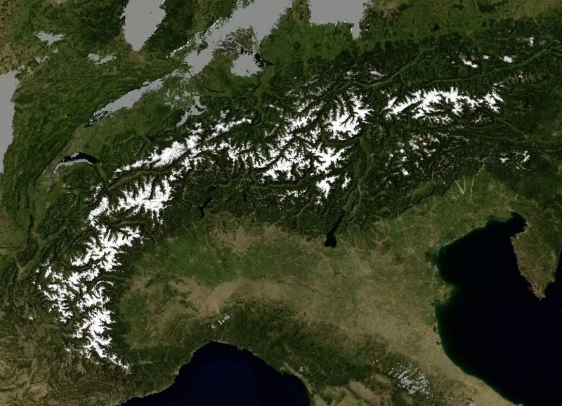
The Alps under constant observation: here is the Sentinel Alpine Observatory
The Observatory of Eurac Research is the international reference point for Alpine satellite data. Skills and data are made available to scientists and administrators who monitor changes in the territory.
Over 300 thousand square kilometers of territory photographed every three days with a resolution of 10-20 meters. Optical and radar images that depict the mountains day and night, in any weather conditions and that can be used to show features such as the evolution of alpine glaciers, soil conditions and the state of the vegetation health. The Sentinel Alpine Observatory of Eurac Research is a permanent observatory that stores and processes the images of the Alps sent by the Sentinel satellites of the European Space Agency. Researchers organize this information in valuable databases and maps for the international scientific community and administrators of Alpine territories. Area extension, image frequency and detail, environmental monitoring products already validated make this observatory a reference point for the study of mountain areas worldwide.
The so-called snow line is an important variable for calculating the exact amount of mass lost by glaciers during the summer. To locate it, the glaciologists carry out surveys in the few accessible areas of some glaciers. In summer, in what they estimate to be the time of maximum ice erosion, they locate some points with the GPS and draw the lines. If, with these surveys, glaciologists can approximate these lines only for some glaciers, thanks to data sent by Sentinel satellites, Earth observation experts from Eurac Research can draw them, sitting at a desk, at any time of the year for any Alpine glacier.
There are five satellites of the European Space Agency (ESA)'s Sentinel Environmental Program that now orbit the Earth. They are a huge source of information—the glacier extension is just an example—as long as one knows how to get them. For this reason, Eurac Research has founded the Sentinel Alpine Observatory (SAO). For a few years, the Earth observation experts of the South Tyrolean research center have been working on data storing, processing and validation to obtain ready-to-use products. The products are intended for administrators or other researchers and are, for example, high-quality images to monitor forests, soil moisture maps and time series of snow cover, or glacier extension maps. "South Tyrol has been our laboratory for years and now our know-how allows us to broaden the horizon and to become a reference point for Alpine satellite data. No mountain range is monitored at this level; it is a unique experience worldwide," explains Marc Zebisch, Eurac Research climatologist and Director of the Institute for Earth Observation.
Assessing the damage of a whirlwind to the forests, measuring the vegetation productivity and soil moisture to plan irrigation, accurately predicting the rivers discharge during the snow melting periods, and comparing the extent of the snow cover of a given area during winters, are some of the environmental monitoring applications that can benefit from satellite technologies.
Researchers at Eurac Research receive and process Sentinel satellite data every three days (the frequency of the orbit is every six days, but at the latitude of the Alps the passages are more frequent). The data are made available on an online platform accessible to all (http://sao.eurac.edu); to download the data a registration to the portal is needed. The offer ranges from raw or partially processed data - a basic resource to continue research in a specific area - to finished products such as thematic maps or time series of important parameters, which can be used by local administrators.
"One of the unique aspects of this platform is the time scale: the image frequency allows for a constant recording of ground changes, to compare the evolution of phenomena such as soil movements in different areas of the Alpine Arc. In case of natural disasters, it is possible to superimpose images of different periods in order to evaluate the damage", adds Carlo Marin, Eurac Research remote sensing expert.
The Sentinel Alpine Observatory (SAO) is an open platform that collaborates with other international networks, such as the Earth Observation Data Center (EODC), and the Virtual Alpine Observatory (VAO). The researchers' idea is to "make this platform as widely known as possible, in order to become a tool to stimulate research on the Alpine environment," concludes Carlo Marin. To foster this networking, researchers will publish their completed and ongoing works on the following blog http://sao.eurac.edu/blog.
Weitere Informationen:
https://www.youtube.com/watch?v=meYQhU6TVT4
Die semantisch ähnlichsten Pressemitteilungen im idw


