
More Precise Fire Extinguishing From the Air Using Simulation and Sensor Data
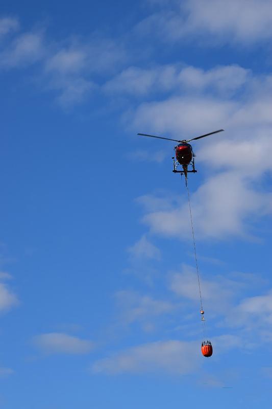
Wildfires are becoming more frequent and more intense worldwide. Fires often become infernos due to heat, drought and wind, especially in the summer. The problem is compounded by the climate crisis. Researchers at the Fraunhofer Institute for Industrial Mathematics ITWM and the startup CAURUS Technologies GmbH are responding to this growing global threat. They are collaborating to develop a machine learning system for more precise aerial firefighting that determines the fire situation in real time and calculates the optimum aerial drop time.
Ever more intense wildfires, increasing water shortages, climate change and CO2 emissions are posing challenges for emergency services conducting modern aerial wildfire suppression. New technologies are needed that enable faster fire suppression, lower water consumption, more efficient helicopter deployment and greater safety for emergency personnel. In the Forest Shield project, researchers at Fraunhofer ITWM are collaborating with CAURUS Technologies to develop a data-driven decision-support system that makes aerial firefighting more precise and safer. This innovative system combines CAURUS Technologies' mobile sensor platform with a prediction system and Fraunhofer ITWM’s MESHFREE simulation software. Aerial drops are predicted and optimized in real time to improve efficiency. The result is a learning system that makes it easier for emergency responders to plan, conduct and evaluate their operations. The project is funded by the German Federal Ministry of Research, Technology and Space (BMFTR) in the context of the FFFLab (ForestFireFighting TransferLaboratory) innovation community.
Real-time support in ongoing operations
The success of aerial water drops often depends on the experience of the helicopter crew. Drop effectiveness is affected by many factors such as wind or the type of forest. “Emergency responders are usually sitting alone in the helicopter. They have to focus on flying while simultaneously deciding where best to drop the water over the burning forest—a difficult task in heavy smoke,” Fraunhofer ITWM research scientist Dominik Loroch describes the challenge. Emergency responders open the bottom of the fire suppressant bucket at a relatively low altitude of 15 to 40 meters. Wind and thermals affect the distribution of the extinguishing agent on the ground. To make matters worse, valuable time is lost between drops while the water bucket is being refilled. Recent studies show that even slight changes in the drop, such as altitude and timing, can improve suppression effectiveness by more than 20 percent. This makes immediate feedback highly valuable. Despite this, the state of the art has thus far focused on advance simulations of optimal firefighting campaigns rather than on dynamic support during ongoing on-site operations. “This is where the added value of our system comes to bear. It improves safety for helicopter crews by enabling more precise, situation-specific targeting from a higher altitude,” says Loroch.
Intelligently linking sensor data and simulation
The CAURUS Technologies sensor platform is mounted above the extinguishing water bucket and uses HD and infrared cameras as well as position sensors to provide real-time data on the fire situation. The data can be georeferenced, i.e., localized on a map, thus providing a comprehensive picture of the fire situation. Furthermore, the sensor data will now be used in the Forest Shield project to provide real-time predictions on suppressant drops. This enables response management to see the precise benefit from each drop.
However, many datasets are needed to quickly and correctly train the prediction systems for the complex aerial water drops. And this is precisely where the MESHFREE simulation software comes into play. The sensor and image data from the CAURUS sensor platform enable the creation of a digital twin of the drop area and to precisely simulate and analyze water drops with simulation models. The MESHFREE software generates physically accurate simulations by incorporating climatic factors such as wind and forest structure in the planning process. The ability to subsequently modify drop conditions and other parameters and to process alternative scenarios provides added value. This generates significantly more information from each deployment, directly contributing to improving predictive models in the field.
“The real-time forecasting system is based on the simulation data from our MESHFREE software. MESHFREE simulates the path of the water droplets from the bucket to the fire on the ground, accounting for all environmental factors,” explains Fraunhofer ITWM research scientist Isabel Michel. Machine learning surrogate models, i.e., simplified models that approximate complex simulations and run significantly faster, learn from simulation data and statistically capture the complex aerial drop dynamics. These provide rapid predictions directly at the deployment site. The recorded real-world drop data is then fed back into the simulation system, continuously improving the predictive models. This results in a cloud/edge system that continuously learns and refines its predictions on each new deployment.
Next-generation aerial firefighting
Not only does the new technology assess the fire situation, it also suggests the best drop time, evaluates real effectiveness and provides immediate feedback to the response team. “We measure reality with the CAURUS Technologies' sensor platform, and we create a digital version of the drop scenario—a digital twin—with the physical simulation,” says Loroch.
The result of the project will be a system combining sensor data, simulation and real-time predictions to clearly indicate drop efficiency for the response team. The project partners presented an initial prototype in June of this year at INTERSCHUTZ 2026 in Hannover. This is the leading international trade fair for participants such as fire departments and disaster response teams. The demonstrator will be completed by the end of the project in July 2027 and will then be tested in test flights in collaboration with fire departments.
The vision for the future is a platform that will help improve the planning and execution of firefighting deployments. For example, the spread of a fire can be predicted, thus enabling adjustments to the planning of extinguishing agent distribution. Trapped individuals and vehicles can be located and reported to response management. Nature conservation issues can also be addressed by accounting for areas warranting special protection.
Weitere Informationen:
https://www.fraunhofer.de/en/press/research-news/2026/july-2026/more-precise-fire-extinguishing-from-the-air-using-simulation-and-sensor-data.html
Ähnliche Pressemitteilungen im idw